 Baltica
Uncommon
Rarity: Uncommon
A topic a little better known than average, read and translated beyond its own country.
Rarity follows how well known the article is: its views on the French and English Wikipedia over a year, and the number of languages it exists in.
At a glance
- Class
- Place
- Domain
- History and politics
- In collections
- Nobody has pulled it yet.
What Wikipedia says
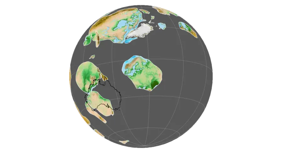
Baltica is a paleocontinent that formed in the Paleoproterozoic and now constitutes northwestern Eurasia, or Europe north of the Trans-European Suture Zone and west of the Ural Mountains.
Excerpt from the Wikipedia article “Baltica”, under the CC BY-SA 4.0 license. Read the article on Wikipedia
Image: Fama Clamosa Citations:[1][2] Rodinia model from Precambrian Research (1100 - 530 Ma): Li, Z.X., Collins, A.S., Davidson, A., De Waele, B., Ernst, R.E., Fitzsimons, I.C.W., Fuck, R.A., Gladkochub, D.P., Jacobs, J., Karlstrom, K.E., Lu, S., Natapov, L.M., Pease, V., Thrane, K., and Vernikovsky, V., 2008, Assembly, configuration, and break-up history of Rodinia: A synthesis: Precambrian Research v. 160, p. 179–210. EarthByte Coastlines: Bohlander, J. and Scambos, T. 2007. Antarctic coastlines and grounding line derived from MODIS Mosaic of Antarctica (MOA), Boulder, Colorado USA: National Snow and Ice Data Center. Gorny, A. J. 1977. World Data Bank II General User GuideRep. PB 271869, 10pp, Central Intelligence Agency, Washington, DC. Matthews, K. J., Maloney, K. T., Zahirovic, S., Williams, S. E., Seton, M., and Müller, R. D., 2016, Global plate boundary evolution and kinematics since the late Paleozoic: Global and Planetary Change, DOI: 10.1016/j.gloplacha.2016.10.002. Seton, M., Müller, R.D., Zahirovic, S., Gaina, C., Torsvik, T. H., Shephard, G., Talsma, A., Gurnis, M., Turner, M., Maus, S., and Chandler, M. 2012. Global continental and ocean basin reconstructions since 200 Ma, Earth-Science Reviews, 113: 212-270, DOI: 10.1016/j.earscirev.2012.03.002. Soluri, E. A., and Woodson, V. A. 1990. World Vector Shoreline, Int. Hydrograph. Rev., LXVII(1), 27-35. Wessel, P., and Smith, W. H. F. 1996. A global, self-consistent, hierarchical, high-resolution shoreline database, J. Geophysical Res., 101(B4), 8741-8743. Global topography: Amante, C. and Eakins, B. W. 2009. ETOPO1 1 Arc-Minute Global Relief Model: Procedures, Data Sources and Analysis. NOAA Technical Memorandum NESDIS NGDC-24, 19., CC BY-SA 4.0, via Wikimedia Commons.
Open free boosters and add Baltica to your collection.
Play for free