 River Stour, eastern England
River Stour, eastern England
Common
Rarity: Common
The most frequent rarity: most Wikipedia articles become Commons.
Rarity follows how well known the article is: its views on the French and English Wikipedia over a year, and the number of languages it exists in.
At a glance
- Class
- Place
- Domain
- Nature
- In collections
- Nobody has pulled it yet.
What Wikipedia says
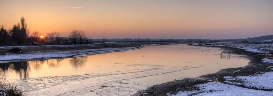
The River Stour ( (rhyming with either "tower" or "sour") is a major river in eastern England. It is 47 miles (76 km) long and forms most of the county boundary between Suffolk to the north, and Essex to the south. It rises in eastern Cambridgeshire, passes to the east of Haverhill, through Cavendish, Sudbury, Bures, Nayland, Stratford St Mary and Dedham. It becomes tidal just before Manningtree in Essex and joins the North Sea at Harwich.
Excerpt from the Wikipedia article “River Stour, eastern England”, under the CC BY-SA 4.0 license. Read the article on Wikipedia
Image: Prioryman, CC BY-SA 3.0, via Wikimedia Commons.
Open free boosters and add River Stour, eastern England to your collection.
Play for free